Speicherstadt and Kontorhaus District: Facts and Figures

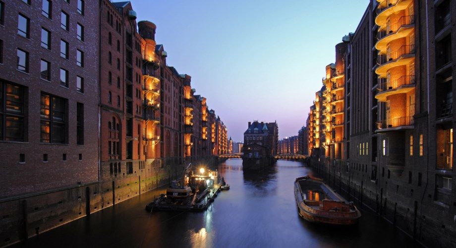
- Hamburg’s largest coherent ensemble of listed buildings
- listed since 15/05/1991 (incl. reconstruction phase, roads, open spaces, canals, quay walls and bridges
- Location: central inner-city location south of the old town, situated on both sides of the former Elbe islands of Kehrwieder and Wandrahm
- Surface Area: 26 hectares
- Spatial Extension: 1.5 kilometres between Baumwall/Niederbaumbrücke (west) and Oberhafen/Oberbaumbrücke (east); 150 to 250 metres between Zollkanal (north) and Sandtorkai (south)
- Number and Names of Storehouses: 17 building complexes (15 today), with storage blocks numbered in alphabetical order from A to X (F and I not assigned); storage area of approximately 300,000 square metres
- Developer: Hamburger Freihafen-Lagerhaus-Gesellschaft (HFLG, now HHLA)
- Architects/Planners: chief engineer Franz Andreas Meyer (head of planning; construction deputation), Georg Thielen, Hanssen & Meerwein, Gustav Schrader, Stammann & Zinnow
- Construction Period: 1885–1927, with three construction phases: 1885–1889 first phase (roads, canals, storage blocks A to O = 60 percent of total storage area); 1891–1896 second phase of construction (blocks P, Q, R); 1899-1927 third phase of construction (blocks S to X; interrupted by World War I and inflation); fourth phase of construction (blocks Y, Z) was scheduled but never implemented.
- Inauguration: 29 October 1888 by Kaiser Wilhelm II
- Structure/Urban Development: uniform structure, only slight differences between individual building structure types, long stretches of brick and clinker buildings with landside access and waterside access via canals
- Foundations: approximately 3.5 million oak piles with a depth of up to 12 metres
- Construction Method: skeleton construction, initially iron girder structure, changed to wooden beam structure with oak supports due to danger of collapse in the event of fire; concrete-encased iron pillars in third phase of construction; reconstruction and new construction after World War II using reinforced concrete
- Architectural Style: Historicism (Hanover school of architecture)
- Storehouses: Neo-Gothic, red-brick façades with hatches, lucarnes and winch booms; in third phase of construction additional waterside stair towers (“Westfalen towers” as escape routes); HFLG administration (“town hall” of the Speicherstadt, 1902–1904): red faced brickwork with sandstone structures evoking a Renaissance style
- Fittings: Hamburg’s first large-scale building complex with full exterior and interior electrical lighting; waterside and landside winches
- War Damage: more than 40 percent destroyed, reconstruction from 1952 based on historical layout while retaining the masonry that had been preserved (new design of blocks G, O, R, and T); blocks A, B, C and J were not rebuilt (today the Hanseatic Trade Center is located on the former sites of A , B, C, J and K)
- Flood Control: located outside Hamburg’s main dike line; ground level between 4.5 and 5.5 metres above sea level (design water level: 7.3 metres above sea level); flood protection measures only available for parts of the storehouses (protection of property)

Major Kontorhaus Buildings
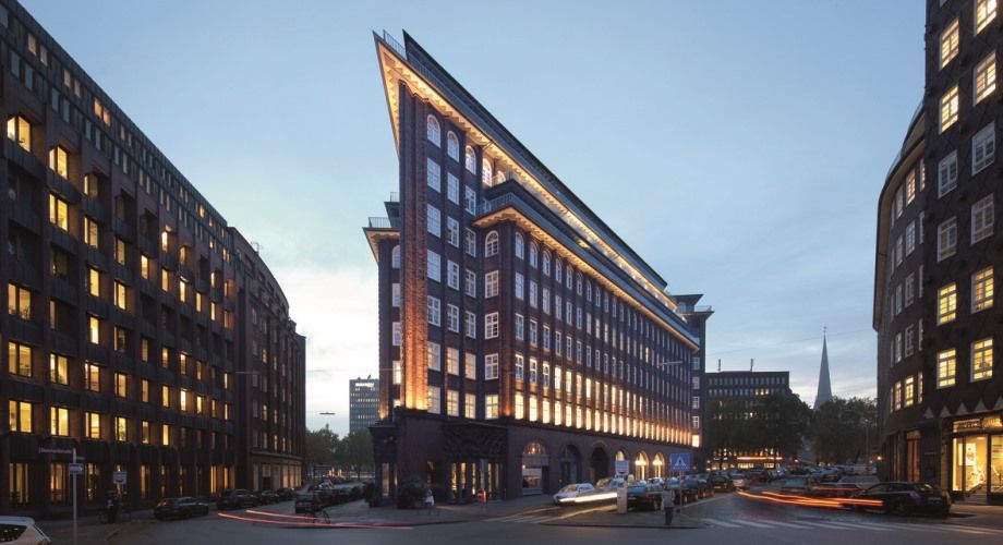
- Chilehaus (Fritz Höger, 1922–1924)
- Messberghof (“Ballinhaus” at first, Hans and Oskar Gerson, 1922–1924)
- Sprinkenhof (Fritz Höger, Hans and Oskar Gerson, 1927–1943, three construction phases)
- Mohlenhof (Rudolf Klophaus, August Schoch and Erich zu Putlitz, 1927/28)
• Concept of the “Kontorhaus”: leasable office building (influenced by US commercial properties and Berlin department store), small-scale usage, primarily port-based and port-related industries; flexible floorplans, flexible options for division, reinforced concrete or steel skeleton construction, stairs, lifts and toilets built around a compact core, high technical standards (around 1900: paternoster, central heating, electric lighting, telephone lines)
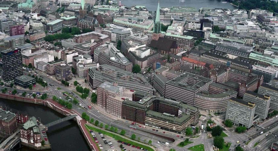
• Location: centrally located in the southeast of the city centre and southeast of the Hammaburg, Hamburg’s nucleus (today: Domplatz), situated between Steinstrasse (north), Klosterwall (east), Messberg (south) and Brandstwiete (west)
• Spatial Extension: around 250 metres (north – south) and 600 metres (east – west)
• Planning Context: the demand for office space had increased with the growth of the port; Hamburg’s old town was redeveloped following the cholera epidemic of 1892; from 1913 the Gängeviertel quarters (tenements in narrow streets) were partially demolished; 1914 urban design competition; in 1926 the development scheme was redesigned by Fritz Schumacher (also including enlargement of Burchardplatz)
• Urban Planning: consistent development of modern city centre, monofunctional service quarter, the ten-storey buildings (Chilehaus, Messberghof) are among the first high-rise buildings in Germany; uniform design: red-brick blocks, flat roofs with stepped storeys

• Location and Site: uneven plot, integration of Fischertwiete (street) into superstructure, redevelopment of “Haus der Landherrenschaft” (Depenau 1 / Klingberg 1, built by Albert Erbe between 1906 and 1908)
• Surface Area: 36,000 square metres of floor space, 6,000 square metres of ground plot
• Developer: Henry Brarens Sloman (importer of saltpetre from Chile, Hamburg’s most affluent citizen at the time; 1921 acquisition of development site)
• Architect: Fritz Höger
• Construction Period: 1922–1924
• Architecture and Design: Brick Expressionism, small axis, vertical single rhythm of façades, monumental in character, ship bow motif (long design process, 17 planning applications were submitted to Hamburg’s Senate), side of façades both flat and curved, Andean condor at the top, ceramic works by Richard Kuöhl
• Construction Method: ferro-concrete skeleton construction, façades largely made of solid masonry, axial dimension: 6.18 metres, all façade pillars (including non-structural ones) have the same width (0.72 metres); ten storeys, of which four are stepped
• Additional Figures: a total of 4,000 workers were involved in the building process; built with 4.8 million bricks (which Sloman had bought from stagnating building projects during the inflation period)
• Listed Building since: 27 September 1983